Monday, July 10, 2017

2017 Tandem Rides July - Georgetown-Newburyport MA (Sunday July 9)


Route Notes:  Looking for a very flat route,  less than 30 miles due to some knee problems.  Found this North Shore Cyclist "Winter Route".  Roads were generally in excellent condition, smooth pavement. Promised only ~800 feet of elevation gain in 27 miles, and it was quite flat.  A few minor rises.  Farmland scenery, some swampy areas, bike path leading into Newburyport, through the town, then out along the water.  Good bridges for major highway (Rt 95) crossings. 

https://ridewithgps.com/routes/22934488

Start Point:  Perley Elementary School, 51 North St, Georgetown MA

Plants of the Week: Green, green, green, many flowers and blooms.  Sumac starting to come into bloom, with red fibrous flowers.  Day lilies roaring in vibrant orange.  White hydrangeas.  Still some roses around too.  Yucca plants in blooom 

Weather:  Perfect.  Sunny, around 80F.  Low humidity, a bit of wind.

Stops and Sights along the Route:
  • Farmland, not so many animals. Green, tree-lined streets
  • Bike path leading into Newburyport was a pleasure.  Sculptures, and ice cream right at start.  A most pleasant way to enter the town.
  • After ride, visited garden center in Georgetown with some sculptures out front.

Stops After the Ride:  
  • Bradford Tavern for after-ride lunch.
  • Stumbled on Winfrey candies on way home - darn good chocolate and candy shop.


Southernmost extent of bike path leading north to Newburyport.


Sculptures on the bike path, the little sparrow with the big sparrows.


Sumac coming into bloom.


Haley's ice cream at start of bike path, south end.  Good ice cream and burgers if you must.


The orange roar of day lillies.


Mostly inland but we did see a few lighthouses.


Big white hydrangeas


Sculptures for sale at garden center in Georgetown.


Great chocolate and a "for show" piano at Winfreys.  Gave it a whirl with Cleopatra Rag, out of tune and tinny but staff enjoyed it and so did I!

Sunday, June 4, 2017

2017 Tandem Rides June

June 4, 2017 - Cape Ann Clockwise Loop - ~26 miles


https://ridewithgps.com/routes/4620498

Route Notes:  Have been circumnavigating Cape Ann for many years, usually starting in Gloucester Stage Fort Park.  This time tried alternate start at school at SW corner of the loop.  Worked great, plenty of parking, ball playing fields were in use so wasn't completely deserted. Watched kids doing bike stunts at the skateboard park. Bruce Lederer (Bike Rides for Ordinary People, Cycle Massachusetts) first showed me these great cycling roads, probably about 2002-3.

Start Point:  O'Maley Innovation Middle School, 32 Cherry St, Gloucester

Plant of the Week: Lots of abundant bloom and green this time of year.  We particularly liked the purple sage flowers, which we are also enjoying at home, snipped into a tiny vase from our vegetable garden.  Found a dramatic display, bordering front walkway so viola, it's the plant of the week.  Kousa dogwoods looking good, was runner up - I thought I got a picture of one but it turned out to be viburnum. Also saw laburnum, with yellow hanging flower bunches.

Weather:  Rain expected later in the day, so got a somewhat earlier start, ~11 am. Very sunny, beautiful blue skies with some clouds adding much interest. Later in afternoon, about 2 pm or so, it did start to cloud over.  I had forgotten my riding vest, but no matter, perfect biking temps really, slightly cool.  Wind evident but not impeding progress.

Stops and Sights along the Route:
  • From parking area - example of dramatic New England ledge in distance.
  • Great water views going up towards Lanesville and on to Halibut Point.
  • Rockport - Gelato at Robin's Nest, right on Main St
  • Cape Ann Museum - sculpture court, great sculptures - would like to visit museum sometime
  • Gloucester City Hall - magnificent building, towers visible from great distances land or sea
Stops After the Ride:  Mile Marker Restaurant and Bar at the Cape Ann's Marina Resort, 75 Essex Road - a good find!  Dockside bar with entertainment, or quiter restaurant looking out onto marina (our choice).  Indoor pool a big attraction for kids. Restaurant restrooms are also the changing rooms for the pool, so great facility for changing out of bike clothes and cleaning up after the ride.


Crossing on footbridge over "Lobster Cove" into Anisquam, looking south toward Anisquam River.


Another view from footbridge, for my nautical pals in GIS.


Plant of the week - Sage, purple flowers at peak.


Robin's Nest Gelato - 1 Main St Rockport


Window Boxes in Rockport

Misery Island Twin Lighthouses


Beach near Land's End, Penzance Road


Beach Rose

Gloucester City Hall


Great statue in courtyard of Cape Ann Museum


Another viewpoint

Spirit of the Sea (1915, bronze) - Albert Henry Atkins (1880-1951)

Spirit of the Sea - detail of base.  Scary sea monsters?

Plant of Week Runner Up - Virburnum (thought it was Kousa Dogwood)

Mile Marker Restaurant at Cape Ann's Marina Resort


Sunday, May 28, 2017

2017 Tandem Rides April-May

April 16, 2017 - Westford MA 24 Mile Loop


https://ridewithgps.com/routes/20351920


First ride in 2017 for the Dragonfly tandem - and our anniversary (29 years).  Plant of the week - forsythia was a strong competitor but Sally preferred lilacs.  Rest stop at Nashoba Valley Ski area, sat on picnic table looking out onto the slopes.  Not quite with the program, I neglected to take pictures.  A fun first ride, road testing the bike - no problems at all.

Since it was our anniversary, after the ride we ate at Moonstones restaurant in Chelmsford - shared a split of champagne!


Picked up this image online from www.mami-eggroll.com.

May 7, 2017 - Ipswich MA - 30 Miles


https://ridewithgps.com/routes/20541400

Route Notes:  This ride did not work quite as planned.  Planning tool maps (RwGPS, Google) all indicated that "Labor in Vain Road" was a through road.  In fact, the name is apt - we encountered a robust gate with very clear "No Trespassing" signs at about mile three.  It was a pretty road up to that point with access and views of coastal wetland areas.  After tracing back, went out Argilla road to Cranes Beach.  (Route linked has been edited to remove "Labor in Vain")

Start Point:  Winthrop School, across from Fire Department.  Several spots, good for ride start.

Plant of the Week: Florida dogwoods in pink and more subtle but still spectacular creamy white were unrivaled for plant of the week.  Creeping phlox was evident, starting to creep over flowerbeds but just getting started.

Weather:  Started out warm and mostly sunny but got windier, cooler and cloudier as we road.  Got a later start, about 1 PM.  Finished about 4:30.

Stops and Sights along the Route:
Cranes Beach
Down East Ice Cream
Pingree School (cool sculptures, sitting area overlooking playing fields)

Stops after the Ride:
Ipswich Brewery "Brewer's Table" brew pub
Ithaki Mediterranean Restaurant


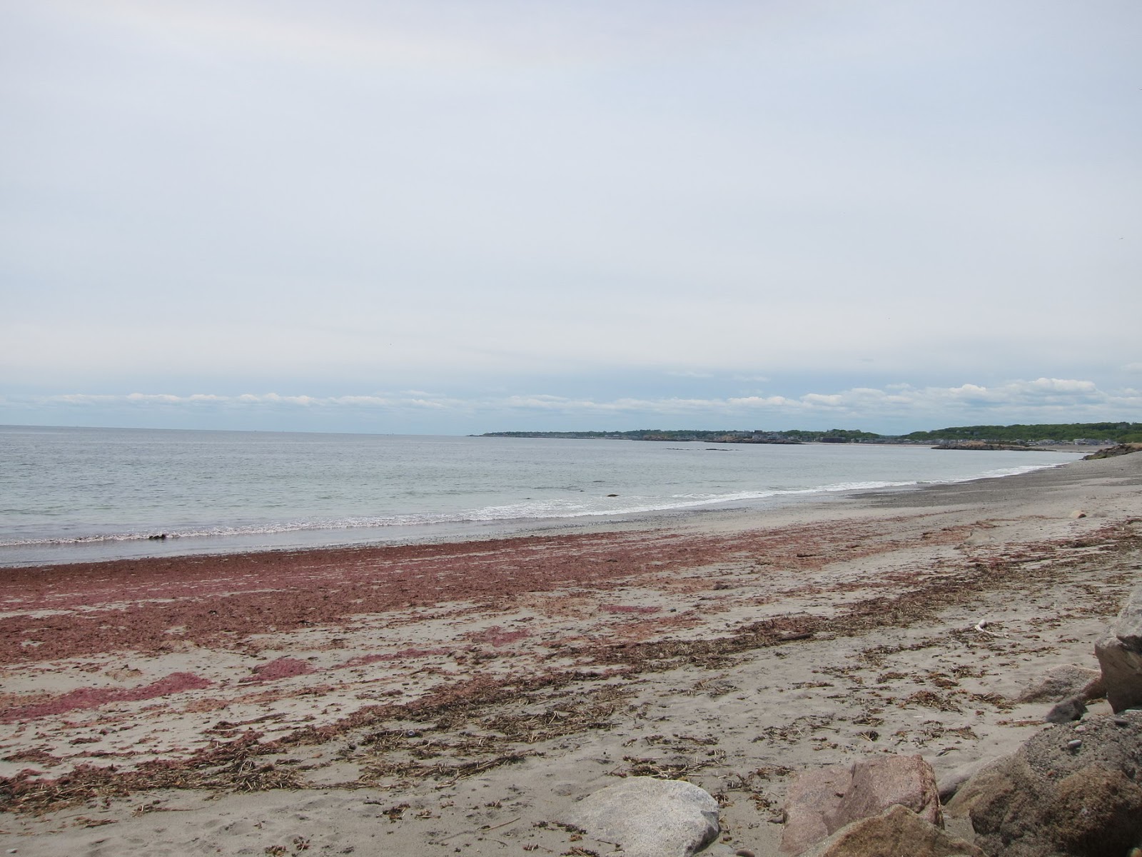
At Cranes beach, shielding from the brisk wind.


Wow, beach plants in bloom - not sure what they are.


First ice cream stop of the season - long lines already!


Tulips looking great.


Cool art at the Pingree School


Cherry vying for Plant of the Week.


Cool dog sculpture where we parked in Ipswich, in front of Winthrop School.


The slightly hidden Ipswich Brewery, brew pub "Brewer's Table".


May 28, 2017 - Wompatuck-Scituate MA - 30 Miles


Route Notes:  This route worked well, learned some new functionality in RideWithGPS such as cutting out parts of a route. The road through Weir River Farm was not exactly public, so will reroute this (will edit route). Explored parts of the Whitney Spur Rail Trail - new pavement in sections, in others, seems to use the tank paths in Wompatuck??  A good 30 mile route.  Might try to incorporate Jerusalem road for even better views next time. The end point also is misplaced in picture above.

Start Point:  Wompatuck State Park, excellent for parking and good bathrooms for changing after ride.

Plant of the Week: Every plant vying for plant of week - bursting forth. But hard to deny rhododendrons, especially the bright hot pink magenta ones. Some were huge.

Weather:  Started out partly cloudy, some wind, about 70F. Cooler and windier toward shoreline.  Started about 12:30 PM.  Finished about 4.

Stops and Sights along the Route:
Scituate Harbor, Nana's Ice Cream
Weir River Farm

Stops after the Ride:
Oysters Bar and Grille, 254 Church St, Pembroke MA - near entrance to Route 3.  Surprisingly excellent food and drinks.  Oysters $1 each 4:30-5:30, I had half dozen from Duxbury, excellent. Sally had appetizer of shrimp and fried artichokes, delicious.  I had cod, done on a risotto cake with a yellow curry sauce.  Perfectly cooked fish, nicely sizzled risotto cake, excellent sauce.  Passed on dessert.  Drove home up 3 to 95 around West side loop.


Flag flying strong at Sciuate Harbor - tattered by prevalent wind here.  The magenta rhododendrons could not be denied as Plant of the Week.  This one actually in our front yard in Arlington, saw some huge ones along the route.


Stoker Sally at Scituate Harbor.  A frequent stop for us - marina, views, seating, bathrooms and ice cream!

This house had a huge flag, dramatically displayed on this Memorial Day weekend Sunday.

Excellent find in Pembroke MA, Oysters Bar and Grille.


Back at home, our lilac was hugely fragrant.  Like, knock you over fragrant.


Monday, May 26, 2014

Tandem Adventure - Ned's Point - May 25, 2014

I found the "Ned's Point Lighthouse Ride" shortly after moving to the Boston area in 2002, in the "Pocket Rides" series.  Back in those days, I relied mostly on books and paper maps to help plan my biking routes. While I like what sites like "RideWithGPS" enable us to do, I still like the books which usually included historical and sightseeing ideas.

There are lots of good rides in this area of southeastern Massachusetts and neighboring Rhode Island.  I've found and also created several variations of my own Ned's Point ride. The version we did is a 50-mile loop, essentially as shown below (Link to Route on RidewithGPS)


The route starts near Lakeville, MA, aptly named as there are several large ponds with great names:  Assawompset, Quitticas (Great and Little), Poksha, Snipatuit, Long Lake.  Even after riding here for several years, I've just begun to have any confidence letting these names roll off my tongue.

Weather started out cloudy, but increasingly sunny throughout the day. We started out at about 11 AM. Wind was present all day, gusty by the time we returned and were blown by winds coming from southeast across the Great Quitticas Lake.

On this Sunday midway through the 2014 Memorial Day weekend, the roads were relatively quiet. At about mile 8 we stopped for a break at Mary's Pond. An osprey was nesting on a tall post at the edge of the lake, we watched while the parents swooped across the open fields and pond and tended the nest.

The peninsula that starts at about mile 13 is called Sippican Neck.  Quiet residential houses and summer homes, an exclusive golf club at the end called Kittansett. On this ride we learned that the road goes all the way out to the tip, around the golf course, great views. Notice the strong, steady wind stretching out the flag.


Found this better map (nautical chart) of the region. There is a nice narrow causeway and beach in the "Planting Island" section. Maybe next time we'll see what's on the "Great Hill Point" peninsula, looks like there may be roads according to GoogleMaps.


We continued around through the quaint town of Marion (almost 100% residential, if there is a restaurant or store they don't seem to show up on Google, and we didn't see any.  Nice marina and waterfront though, quiet roads.

The nasty part of this ride is on Rt 6 West to get to Ned's Point and Mattapoisett. It's a major road, with little shoulder. We were lucky that traffic was very light, although the headwind was strong and loud.  The Oxford Creamery is the landmark for turnoff to Ned's Point. It seems to be an institution, although miraculously we've never stopped.

The park at Ned's Point was delightful, bathroom facilities welcomed, and the lighthouse in good form:


But we had finished our last KIND bar and were getting hungry. Continued to Mattapoisett harbor and joined the line at the ice cream and sandwich stand. Egg salad and chicken salad sandwiches tasted good, along with some ice cream to fuel the ride back.  The general store told us they would start doing lunches in the summer, and some time, we will eat, and maybe even stay at the Inn on Shipyard Park or the Mattapoisett Inn BandB.

Years ago, we took the bike path from Mattapoisett to Fairhaven.  Maybe one day we will do this again.  Could be fun to start ride in this area and stay overnight - I've been wanting to explore New Bedford, especially the New Bedford Whaling Museum.

But this time, we enjoyed the improved route back to the car.  Wolfe Island road is a dirt road, with gravel. We rode most of it, the car tire tracks had made a smooth surface. But I created the NedsPt3 ride with an alternate route that may avoid dirt roads for a future try.

After 40 miles of ultra-flat riding, the zippy hills near the ponds are a lot of fun. Just before this, my knee was feeling cramped, so we took a break.  Thankfully, that seemed to be all it needed, and we took the hills with gusto.  One of the most pleasant endings to a ride, we return across the causeway between two lakes.  This time the crosswind was strong and a little unnerving, but we leaned into it, and completed happily.